Scott A. Lecce
 Professor of Geography
Phone: 252-328-1047
Email: lecces@ecu.edu
Dr. Scott Lecce (Ph.D., 1993, University of Wisconsin-Madison) is a
fluvial
geomorphologist who joined the faculty at East Carolina University in
1998
after holding a tenure-track position at the University of Southern
Mississippi
and a temporary teaching position at Indiana State University. He
has a
master's degree from
Courses:
GEOG 1250
- The Water Planet Syllabus
GEOG 2250 - Earth Surface Systems Syllabus
GEOG 3220 - Soil Properties, Surveys, and Applications Syllabus
GEOG 4210 - Fluvial and Hydrological Processes Syllabus
GEOG 6210 - Advanced Fluvial and Hydrological Processes Syllabus
Research Interests:
Fluvial and hydrological processes; Transport and storage of heavy
metals in
fluvial environments; Human impacts on channel morphology,
erosion, and sedimentation; Hydrologic and geomorphic responses to
environmental change; Flood geomorphology; Desert geomorphology;
Alluvial fan
development; Glacial hydrology.
Current Research Projects:
Floodplain and
Channel Storage of Mining-related Lead in the Big River, Old Lead Belt,
SE Missouri
The
Old Lead Belt is a historic Pb-Zn mining district within St. Francois
County in
Southeast Missouri which was a leading producer of lead worldwide from
1869 to
1972. Major concerns exist about the long-term stability and
toxic risk
of mill wastes and mining sediment in rivers draining mining areas and
major
dump sites, some still presently covering more than 2.5 km2.
Previous studies by Federal and State agencies showed that channel
sediments
are contaminated along the middle and lower segment of the Big River in
the
Missouri Ozarks. The purpose of this study is to quantify the
locations
and volumes of mining sediment storages within channel and floodplain
deposits
in the Big River. Overall, bed, bar, and floodplain deposits are
contaminated with Pb from the town of Leadwood (river km 171) to its
confluence
with the Meramec River near Eureka (river km 0). The total
contaminated
sediment volume in the main stem of the Big River is >90,000,000 m3
with >95% stored in overbank floodplain deposits. Maximum Pb
concentrations
occur in St. Francois County with 2,500 ppm Pb in active channel
sediments and
>12,000 ppm Pb in floodplain deposits. However, only 21% of
contaminated
sediment is stored in St. Francois County, while 79% is stored in
Jefferson
County due to both greater river length and increased valley floor
width and
storage capacity. Historical floodplain deposits are probably the
largest
contemporary source of Pb input to the Big River via bank erosion and
mass-wasting.
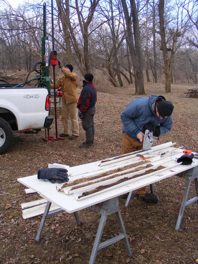
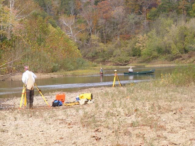
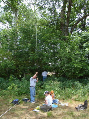
Coring point bar (left) and floodplain (center). Lead concentrations are being determined in the cores on the table using an x-ray flourescence spectrometer. On the right, stream channel transects and longitudinal profiles are being surveyed with a total station and GPS.
Mercury Contamination of Floodplain
Sediments from Historic Gold Mining in
The first documented
discovery
of gold in the
Pavlowsky, R.T., Lecce, S.A., Bassett, G.S., and Martin, D.J. 2010. Legacy Hg-Cu contamination of active stream sediments in the Gold Hill Mining District, North Carolina. Southeastern Geographer 50(4):503-522.
Lecce, S.A., Pavlowsky, R.T., and Schlomer, G.S. 2008. Mercury contamination of active channel sediment and floodplain deposits from historic gold mining at Gold Hill, North Carolina, USA. Environmental Geology 55:113-121.
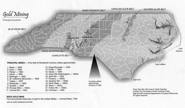
Left: An operational stamp mill at the Reed Mine, where a 17 pound
nugget was
discovered in 1799.
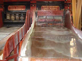
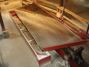
Photo to the right shows a shaking table that vibrates in a
reciprocating
motion to separate fine gold
particles from ore. The table was coated with mercury to
amalgamate
the gold.

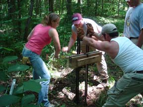
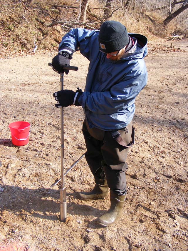
Left: Pounding the core barrel into the floodplain. Right:
Jacking the
core barrel back out.
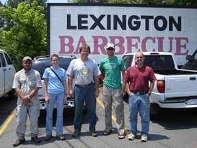
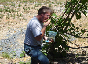
Left: Lunch break at the local BBQ joint. Right: Bob tasting mine tailings for gold.
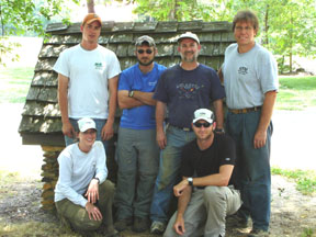
Left: The 2007 field crew. Right: Going five meters deep with an Oakfield soil probe.
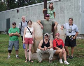
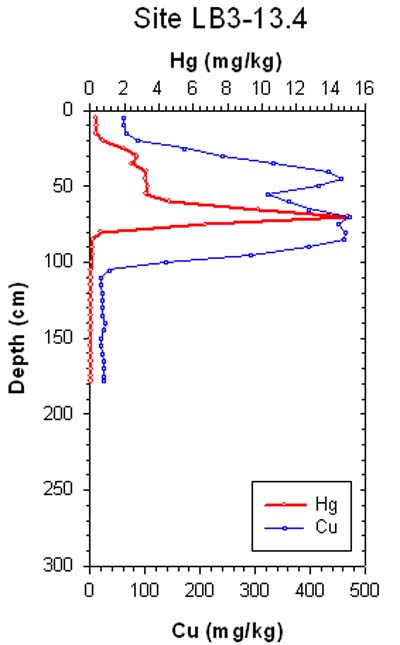
Left: The summer 2006 field crew from
showing a peak mercury concentration 150 times background levels (0.1
ppm) and
15 times the EPA
guideline for contaminated soil (1 ppm). For more
on this project, see:
Floodplain
Sedimentation and Metal
Contamination (funded by the National Science Foundation)
This project (with Bob Pavlowsky, Missouri State University) focuses on: using sediments contaminated by lead and zinc mining in a Wisconsin watershed to reconstruct a150-year history of flooding and sedimentation, examining lateral and downstream changes in metal dispersal processes, and investigating floodplain deposits as a secondary source for the remobilization of metal contaminated sediments. For more on this project, see:
Hurricane Floyd Flood (funded by the National Science Foundation)
The 1999 'Flood of the Century' on the Tar River in eastern North Carolina was the largest in the nearly 100-year long flood record. This project (with Pat Pease, Paul Gares, and ECU geologist Catherine Rigsby) examined the magnitude of overbank sedimentation on the Tar River floodplain and the contamination of the flood sediments by trace metals. For more on this project, see:
Pease P.A., Lecce S.A.,
Gares P.A., Rigsby, C.A. 2007. Heavy metal concentrations in sediment
deposits on the
Tar River floodplain following Hurricane Floyd, Environmental
Geology 51:1103-1111.
Lecce, S.A. 2000. 'Fallacy of the 500-year flood: A cautionary note on flood frequency analysis'. North Carolina Geographer 8: 29-40.
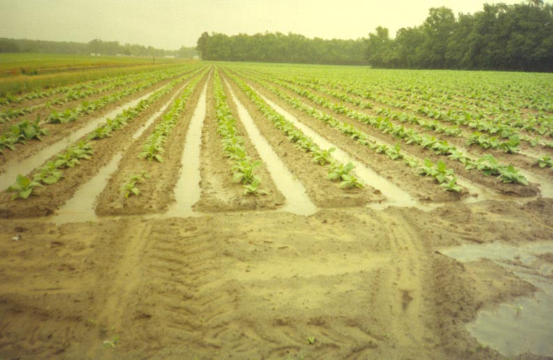
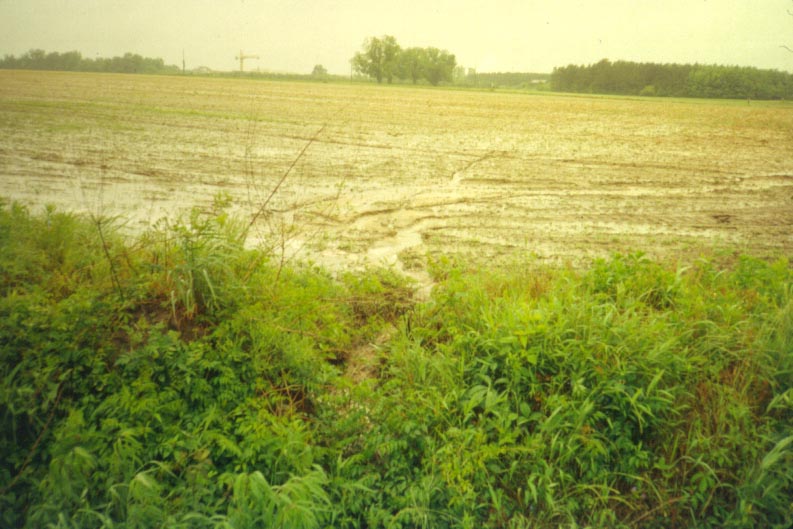
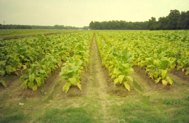
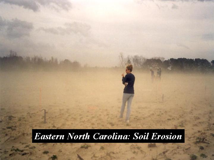
Erosion and
Sediment Transport on
Coastal Plain Croplands
This project involved
assessing
sediment delivery from a small agricultural watershed by measuring
drainage
ditch sedimentation and suspended sediment transport during a 5-year
period. For more on this project, see:
Pease, P.P., Gares, P.A., and Lecce, S.A. 2002. Eolian dust erosion
from an
agricultural field on the North Carolina coastal plain. Physical
Geography
23: 381-400.